Safe and Reliable Flight: Built for Challenging Conditions - Matrice 400 has a protection rating of IP55 [9], allowing it to operate reliably in challenging conditions including heavy dust or rain. It also maintains stable performance across temperatures from -20° to 50° C (-4° to 122° F), delivering consistent results in both hot and cold conditions.
Power-Line-Level Obstacle Sensing [3]:The Matrice 400's advanced obstacle sensing system integrates rotating LiDAR, high-precision mmWave radar, and full-color low-light fisheye vision sensors [13], pushing detection capabilities to unprecedented levels. The system detects even small obstacles like high-voltage power lines across mountainous terrain — even in darkness [3]. It can penetrate rain and fog to sense its surroundings, providing enhanced safety in challenging weather conditions.
Robust Video Transmission: Thanks to the ten-antenna system on the aircraft and the high-gain phased array antenna system on the remote controller, the O4 Enterprise Enhanced Video Transmission System can achieve image transmission up to 40 km [10].
Matrice 400 also supports the sub2G frequency band [5], and when equipped with two DJI Cellular Dongle 2 [11], it can automatically switch to the better available carrier network, providing a more stable signal even in urban interference environments or remote regions.
Matrice 400 has a built-in video transmission relay module. With this setup, one Matrice 400 can serve as a relay drone, flying high to provide relay signals for another Matrice 400 operating at a greater distance. This capability significantly extends the transmission range, making it ideal for search and rescue tasks as well as inspections in mountainous areas.
Aircraft Fusion Positioning: The omnidirectional sensing performance [12] brought by rotating LiDAR, high-precision mmWave radar, and full-color low-light fisheye vision sensors provides Matrice 400 with strong positioning capabilities. It can fly stably close to glass-facade buildings or wind turbine blades and safely return from building edges, mountain bases, or bridge sides even when the return point has not been updated.
Full-Colour Vision Assist: The four full-colour low-light fisheye vision sensors on the aircraft provide Full-Colour Vision Assist [13] to ensure safer flight.
Enhanced Intelligence and Efficiency
Smart Detection [14]: With Zenmuse H30 Series' visible and thermal imaging, Matrice 400 can detect vehicles, vessels, and subjects during search and rescue operations or routine flights. It also supports switching to other models, enabling the expansion of application scenarios. Additionally, it supports high-res grid photos and features powerful tracking capabilities.
Real-Time Terrain Follow: Matrice 400 supports Real-Time Terrain Follow flight in any horizontal direction [15]. This feature can be enabled during both manual flight and automated flight routes, ensuring stable relative height to the ground.
During large-scale search and rescue operations, the size of ground subjects can be kept consistent on the remote controller screen, reducing the need for frequent zoom adjustments and improving efficiency. During mapping missions, a consistent ground sampling distance (GSD) can be maintained to obtain high-precision mapping data.
Takeoff and Landing on Ships [16]: To address the needs of offshore operations such as maritime patrol and wind turbine inspection, Matrice 400 is equipped with the capability to take off from and land on ships, supporting takeoff from stationary vessels and landing on moving vessels. By detecting landing point patterns on the deck, it can achieve safe and precise landings.
TECHNICAL SPECIFICATIONS
Aircraft:
Takeoff Weight (with propellers)
|
Without Batteries: 5020±20 g |
Max Takeoff Weight |
15.8kg |
Dimensions |
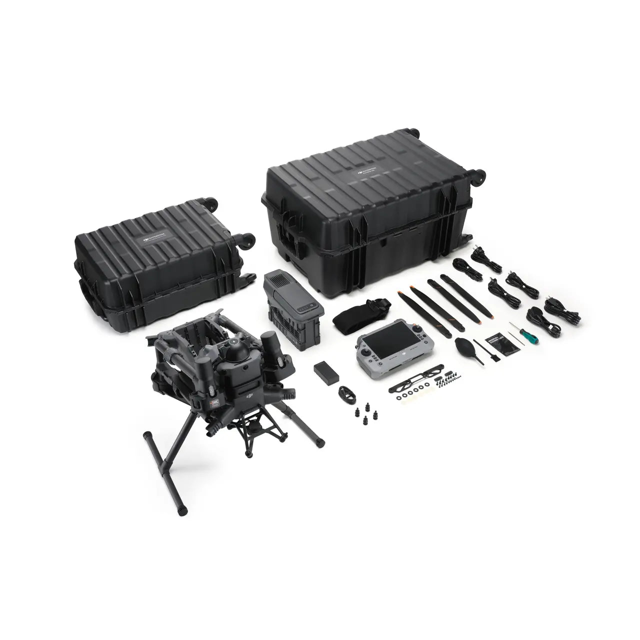
Unfolded: 980×760×480 mm (L×W×H) (with landing gear) Maximum dimensions excluding propellers. Aircraft carrying case dimensions: 779×363×528 mm (L×W×H) |
Max Payload |
6kg The 6 kg payload is measured at the third gimbal connector under sea level conditions. Payload capacity decreases as altitude increases. For details, refer to the official user manual. |
Propeller Size |
25 Inches |
Diagonal Wheelbase |
1070mm |
Max Ascent Speed |
10m/s |
Max Descent Speed |
8m/s |
Max Horizontal Speed (at sea level, no wind) |
25m/s |
Max Takeoff Altitude |
7000m |
Max Flight Time (no wind) |
59 minutes Measured with the aircraft flying forward at a constant speed of 10 m/s in a windless environment at sea level, carrying only the H30T (total weight 10,670 g), and from 100% battery level until 0%. Data is for reference only. Actual experience may vary depending on the environment, usage, and firmware version. |
Max Hover Time (no wind) |
53 minutes Measured with the aircraft hovering in a windless environment at sea level, carrying only the H30T (total weight 10,670 g), and from 100% battery level until 0%. Data is for reference only. Actual usage time may vary depending on the flight mode, accessories, and environment. |
Max Flight Distance (no wind) |
49km Measured by the aircraft flying forward at a constant speed of 17 m/s in a windless environment at sea level, without external payloads, and from 100% battery level until 0%. Actual experience may vary depending on the environment, usage, and firmware version. |
Max Wind Speed Resistance |
12m/s Max wind speed resistance during takeoff and landing. |
Max Yaw Angular Velocity |
Yaw: 100°/s |
Max Pitch Angle |
35º |
Operating Temperature |
-20° to 50° C (-4° to 122° F) (without solar radiation) |
Global Navigation Satellite System (GNSS) |
GPS + Galileo + BeiDou + GLONASS* |
Hovering Accuracy Range (with moderate or no wind) |
Vertical: |
RTK GNSS Accuracy |
RTK Fix: |
RTK Heading |
Supports RTK heading with an accuracy better than 2° |
Airborne ADS-B In |
Equipped with standard airborne ADS-B In receiver and dual antennas, supporting reception up to 20 km. |
Internal Storage |
N/A |
Ports |
USB-C Debug Port × 1: USB 2.0 |
Propeller Model |
2510F |
Beacon |
Built into the aircraft |
Ingress Protection Rating |
IP55 |
Gimbal
| Maximum Payload for Single Gimbal Connector | 1400 g If exceeds, the gimbal damper lifespan will decrease from 1000 hours to 400 hours. |
Maximum Payload for Dual Gimbal Connector |
950 g |
Maximum Payload for Third Gimbal Connector |
3kg for quick-release port, 6 kg for screw lock fastening |
Sensing
| Sensing Type | Omnidirectional binocular vision system (surround view provided by full-color fisheye vision sensors) Horizontal rotating LiDAR, upper LiDAR and downward 3D infrared range sensor Six-direction mm Wave radar |
Forward |
Measurement Range: 0.4-21 m Detection Range: 0.4-200 m Field of View (FOV): 90° (horizontal), 90° (vertical) |
Backward |
Measurement Range: 0.4-21 m Detection Range: 0.4-200 m Field of View (FOV): 90° (horizontal), 90° (vertical) |
Lateral |
Measurement Range: 0.6-21 m Detection Range: 0.5-200 m Field of View (FOV): 90° (horizontal), 90° (vertical) |
Downward |
M easurement Range: 0.5-19 m The FOV to the front and rear is 160° and 105° to the right and left. |
Operating Environment |
F orward, Backward, Left, Right, and Upward: Delicate texture on the surface, adequate light. Downward: The ground has rich textures and sufficient lighting conditions*, with a diffuse reflection surface and a reflectivity greater than 20% (such as walls, trees, people, etc.). * Sufficient lighting conditions refer to an illuminance not lower than that of a nighttime city light scene. |
Rotating LiDAR |
Standard Measurement Range: 0.5-100 m @ 100,000 lux with 10% reflectivity target Measurement Range for Power Line: 35 m @ 30° @ 10,000 lux for 21.6 mm steel-core aluminum stranded wire with a relative body tilt angle of 30° to the left and right Field of View (FOV): 360° (horizontal), 58° (vertical) Point-Frequency: 520,000 points/second Laser Wavelength: 905 nm Eye Safety Level: Class 1 (IEC60825-1:2014), eye-safe |
Upper LiDAR (3D ToF) |
0 .5-25 m at night (reflectivity > 10%) The FOV to the up and down is 60° and 60° to the right and left. |
Downward 3D Infrared Range Sensor |
M easurement Range: 0.3-8 m (reflectivity > 10%) The FOV to the front and rear is 60° and 60° to the right and left. |
mmWave Radar |
M easurement Range for Power Line: 36 m for a 12.5mm steel-core aluminum stranded wire 50 m for a 21.6mm steel-core aluminum stranded wire FOV: ± 45° (horizontal and vertical) The mmWave radar function is unavailable in some countries/regions. |
FPV Camera
| Resolution | 1080p |
Field of View (FOV) |
D FOV: 150° HFOV: 139.6° VFOV: 95.3° |
Frame Rate |
30fps |
Night Vision |
Starlight Grade |
Video Transmission
| Video Transmission System | DJI O4 Enterprise Enhanced Video Transmission System |
Live View Quality |
Remote Controller: 3-channel 1080p/30fps |
Operating Frequency and Transmitter Power (EIRP) |
902-928 MHz: < 30 dBm (FCC), < 16 dBm (MIC) 1.430-1.444 GHz: < 35 dBm (SRRC) 2.4000-2.4835 GHz: < 33 dBm (FCC), < 20 dBm (CE/SRRC/MIC) 5.150-5.250 GHz: < 23 dBm (FCC/CE) 5.725-5.850 GHz: < 33 dBm (FCC), < 14 dBm (CE), < 30 dBm (SRRC) Operating frequency allowed varies among countries and regions. Refer to local laws and regulations for more information. |
Max Transmission Distance (unobstructed, free of interference) |
40 km (FCC) 20 km (CE/SRRC/MIC) Measured in an unobstructed environment free of interference. The above data shows the farthest communication range for one-way, non-return flights under each standard. During your flight, please pay attention to RTH reminder on the DJI Pilot 2 app. |
Max Transmission Distance (with interference) |
Strong interference (dense buildings, residential areas, etc.): approx. 1.5-6 km Medium interference (suburban counties, city parks, etc.): approx. 6-15 km Weak interference (open spaces, remote areas, etc.): approx. 15-40 km Data is tested under FCC standard in unobstructed environments of typical interference. Only to serve as a reference and provides no guarantee as to the actual flight distance. |
Max Download Speed |
S tandard Mode: 80Mbps Downlink Playback Download: < 25 MBps Single-Channel Bitrate: ≤ 12 Mbps The above data was measured under conditions where the aircraft and remote controller were in close proximity without interference. |
Antenna |
W LAN Antenna × 8: 6 vertically polarized antennas and 2 horizontally polarized antennas sub2G Antenna × 2: 2 vertically polarized antennas 4G Antenna × 4 Operating Mode: 2T4R |
Others |
Supports Dual Control Mode and 2-channel Cellular Dongle 2 |
Battery
| Model | TB100 |
Capacity |
20254 mAh |
Standard Voltage |
48.23 V |
Max Charging Voltage |
54.6 V |
Cell Type |
Li-ion 13S |
Energy |
977 Wh |
Weight |
4 720 ± 20 g |
Charging Temperature |
5 ° to 45° C (41° to 113° F) |
Discharging Temperature |
- 20° to 75° C (-4° to 122° F) |
Battery Heating |
Single Battery: Support Onboard: Support Battery Station: Support |
Discharge Rate |
4C |
Max Charging Power |
2C |
Low-Temperature Charging |
Supports low-temperature self-heating charging |
Cycle Count |
400 |
Intelligent Battery Station
| Model | BS100 |
Net Weight |
11.8 kg |
Dimensions |
6 05×410×250 mm (L×W×H) |
Supported Batteries |
TB100 Intelligent Flight Battery, TB100C Tethered Battery WB37 Battery |
Operating Temperature |
- 20° to 40° C (-4° to 104° F) |
Input |
100-240 V (AC), 50-60 Hz, 10 A |
Output |
U SB-C: TB100 Battery Interface: 100-110 V: Approx. 1185 W 110-180 V: Approx.1474 W 180-240 V: Approx. 2184 W WB37 Battery Interface: 100-240 V: Approx. 52 W USB-C: 5.0 V 3.0 A, 9.0 V 3.0 A, 12.0 V 3.0 A, 15.0 V 3.0 A, 20.0 V 3.25 A |
Number of Charging Channels |
Three TB100 and two WB37 batteries |
Charging Mode |
Ready-to-Fly Mode 90%; Standard Mode 100% Supports Fast Charging Mode and Silent Mode |
Charging Time |
TB100/TB100C Battery From 0% to 100%: 220 V: 45 minutes (Fast Charging Mode); 110 minutes (Silent Mode) 110 V: 70 minutes (Fast Charging Mode); 110 minutes (Silent Mode) Charging time is measured in a test environment with a temperature of 25° C. |